Sunday 3 August 2014

Richard MacCormac: The City in Miniature


As a tribute to the late Richard MacCormac I thought I would post a few photos of his buildings in Oxford.

Jowett Walk, Balliol College. 


This is an example of his penchant for articulating a building as a series of towers.

The Garden Quadrangle, St John’s College.


This deeply historicist building was voted by the Oxford public as the best new building to be completed in Oxford in the last 75 years.

Kendrew Quadrangle, St John’s College.


An impeccably modernist building which reinterprets the quadrangle typology. It is a beautifully detailed building, mixing timber, steel and glass. It incorporates decoration distinctly influenced by Frank Lloyd Wright.

I have to admit I am puzzled by Richard MacCormac’s nomination of Burrell’s Fields at Trinity College, Cambridge as his best project, a project I admittedly haven’t seen in the flesh. If I had to nominate my favourite  MacCormac project  I would probably choose   the Bowra building in Wadham College. This building introduced me to the idea that there was more to MaCormac in Oxford than the Sainsbury building at Worcester College.


The student rooms are distinctly articulated, either by L-shaped  plans  or bay windows into two zones. This meets the  dual purpose needs of these rooms: studies and bedrooms. They are expressed as a series of towers. Expressing such small rooms as individual towers conveys an impression like that of a metropolis. However, perhaps the most inspired space in this building, intriguingly lies at the heart of the structure.


What is this space? Is it an external corridor or an internal street? It is remarkable, the way in which something as simple as stairs  can express the edge condition of a building so forcefully.

This is an example of the building as city in miniature;  a concept many architects have aspired to but rarely achieved as successfully as here. It is indicative of the level of intelligence at which MacCormac practiced architecture. I suppose many gardeners have produced remarkable things but only a master can produce a bonsai.

It is always a little sad that when someone as rich as Lord Sainsbury wishes to gift a building to a university, he chooses somewhere already financially as well endowed as Oxford University. Wouldn’t be good if poorer universities were occasionally gifted outstanding buildings? Still, must focus on the bright side. Great architect and great guy.


Sunday 4 May 2014

The British Garden City Movement: Bedford Park


Jane Jacobs attacked the Garden City movement when she stated that “its prescription for saving the city was to do the city in.” Was this criticism justified? Well, the answer is surely yes and no. Firstly, the original Garden City movement was an attempt to deal  with the growth of existing cities by proposing satellite communities. The size of existing cities would be limited by green belts. These would help  define a city’s  size, maintain a balance between city and country and by forcing new developments into existing sites in a city  act as a catalyst for urban regeneration.

The idea of satellites was basically an offshoot of its concern about  the issue of city size. Bedford Park, in west London, is often taken as a good example of the Garden City Movement though its proximity to central London ensures it should really be viewed as a neighbourhood of an existing city rather than a true satellite.
An important fact about Bedford Park is the date of its founding, 1875, which gives it some claim to be the origin of the Garden City Movement.

The development is often viewed as the work of Richard Norman Shaw although Shaw was actually the second architect to be appointed by the client, Jonathan Carr. Other architects who worked on the development included Edward W Godwin, Maurice Adams and EJ May.


The development is centred around Acton Green Common and the adjacent Turnham Green  tube station. Here are the non-residential uses such as parade of shops, church and pub. 


Shaw was  responsible for buildings which compromise centre pieces of the development such as St Michael &  All Angels Church  and  the Tabard Pub.


                                     Shops on The South Parade.

A series of residential streets fan out from this heart of the community.


                                                     Priory Gardens


The houses by Shaw at 22 Woodstock Road  are surprisingly not the best in the development.


High density housing has been allowed on part of the site.

Richard Norman Shaw is remembered as one of the most eclectic architects of the Nineteenth Century, responsible for buildings such as New Scotland Yard  on the Thames Embankment and the less interesting Piccadilly  Hotel.

Much of the development has been designed in what became known as The Queen Anne Style.   It is something of a historical curiosity that Richard Norman Shaw, a   half-Irish, half-Scottish architect should devote his career to this English, or to be more precise, Dutch style of architecture.

Dutch motifs such as bell gables can be found throughout the development. Many of these houses are not actually by Shaw himself.


Should this approach be regarded  as something simply producing surface effects rather than any deeper, spatial qualities, the sort of criticism sometimes leveled at the  work of John Nash? Well, to give an informed answer to that question I would have to have seen more Shaw interiors and I can only recall visiting the interior of two buildings by  Shaw ,  Swan House on Chelsea Embankment and The Royal Geographical Society in South Kensington and  both indeed provided a memorable experience.


At any rate, the development contains some of the prettiest houses in London.


The development has provided a home for famous residents such as W.B. Yeats, Camille Pissarro and, in more recent years, John Humphrys of the  BBC. It also appeared in the  G.K. Chesterton novel The Man who was Thursday under the name Saffron Park.

It is true that the garden City movement as conceived by Ebenezer Howard had little to say about existing cities and hence offers little guidance on issues such as the regeneration of inner-city  sites. It that sense, it cannot be said to be a comprehensive theory of urban design. Its concern for issues such as city size and satellites did evince an ability  to think in regions, something often sadly amiss from today’s thinking on urban design.

Wednesday 9 April 2014

Flickr Has Arrived


I have done what I have intended to do for some time; start uploading some of my large photo archive to Flickr.

A few years ago I was lucky enough to visit Copenhagen so this is my first set of photographs.


Monday 7 April 2014

Cambridge’s Unique Green Belt


Cambridge has a unique green belt; unique in that it is actually embedded within the fabric of the city. It is possible ( well almost) to walk in a circular route through the city centre without straying from green land.


The sequence of spaces starts at the Fen’s Causeway which leads onto “The Backs”.


“The Backs” follow the route of the river Cam.


If you wish to vary this route, you can occasionally  venture into the city of Cambridge itself encountering streetscape of incredibly high quality.


The architecture and its detailing is  similarly astounding.


View from the Avenue, Trinity College.


St Giles Church at the intersection of Castle Street and Chesterton Lane.


Jesus Green.


Houses on Short Street.


Christ’s Pieces.


Parker’s Piece


Unlike Oxford, Cambridge’s  science park is not separated from the city by a strategic “green break”  but is located on the north of the city, within the boundary of the ring road.

It is perhaps for this reason that  a proposed satellite town, Northstowe, will be located five miles to the north-west  of Cambridge on a site between the villages of Oakington and Longstanton. This development is master-planned by Arups and it will be exciting to see how it turns out.

Thursday 3 April 2014

Oxford Landscapes


The landscapes in and around Oxford provide, for me, ample food  for thought regarding approaches to urban design. Take this example, a view from Blenheim Palace, just north of Oxford. This naturalistic landscape has virtually nothing natural about it and was created to the designs of Capability Brown. A contrived landscape like this evokes many picturesque associations. When I see the island on the lake with its tall  Cyprus trees , like many I imagine, I am reminded of the painting  The Isle of the Dead by Arnold Brocklin.  A late Romantic like Arnold Bocklin was simply referring back to the picturesque tradition, a tradition which predates Capability Brown himself.


Landscapes like this and similar landscapes like Stowe are often taken as the pinnacles of British landscape design. Personally, however, I would rather be in Oxford itself. Surely a city like this provides the ultimate example of  a garden city, a city where landscape has been married to architecture to produce perhaps the most delightful, liveable city in the UK.

The Botanic Gardens, the grounds of Christ Church College, Port Meadows, the University Parks together with ten of the college gardens are on the national list of historic parks and gardens. In all, there are 417 gardens and parks  within the boundary of the City of Oxford which are usually accessible to the public. 52% of the land within the city is green land.


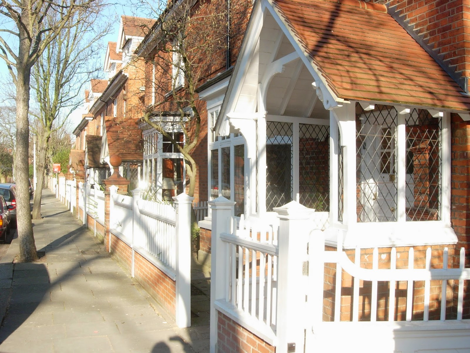
As you move through the fabric of Oxford, you become aware of what seems like a basically urban spectacle.


Only when you get closer to buildings do you become aware of another dimension. Vistas open out to reveal extraordinary natural landscaping such as the grounds of Trinity College.


A landscape replete with routes and incidents. 


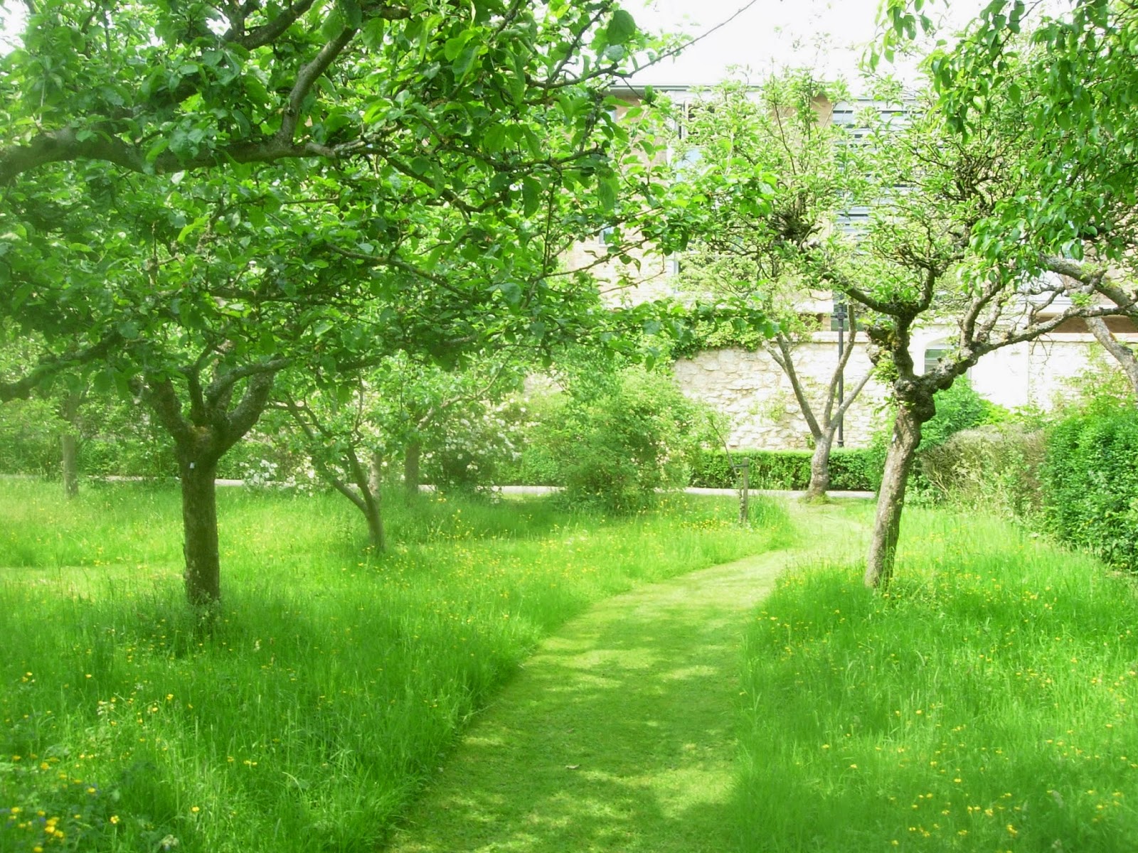
Worcester College incorporates an orchard within its grounds.


Cars are almost entirely banned from the centre of Oxford. This allows streets to be appropriated in the summer for cafes. Park and ride facilities allow motorists to park at the edge of the city and take public transport into the centre.


Bike lanes have been provided throughout the city.


The city’s name refers to its origins as a fording place on a river. The city is sited around the confluence of two rivers, The river Isis  (Thames)  and Cherwell. These, together with the Oxford canal have created ample opportunity to create linear parks.


The Oxford canal on the right with the Isis (Thames) to the left.


The river Cherwell resembles an Indian river in that it seems to have two river beds. Its flood plain creates a linear park in the centre of the city.


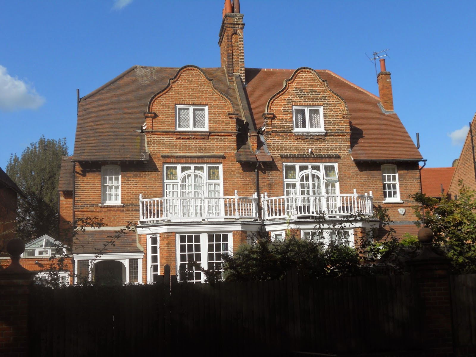
Privacy is allowed in the college grounds by the simple device of the railing. This allows views in but prevents straying members of the public wandering in.


An additional   level of privacy is created by the simple device of the wall used to enclose   the famous quadrangles.


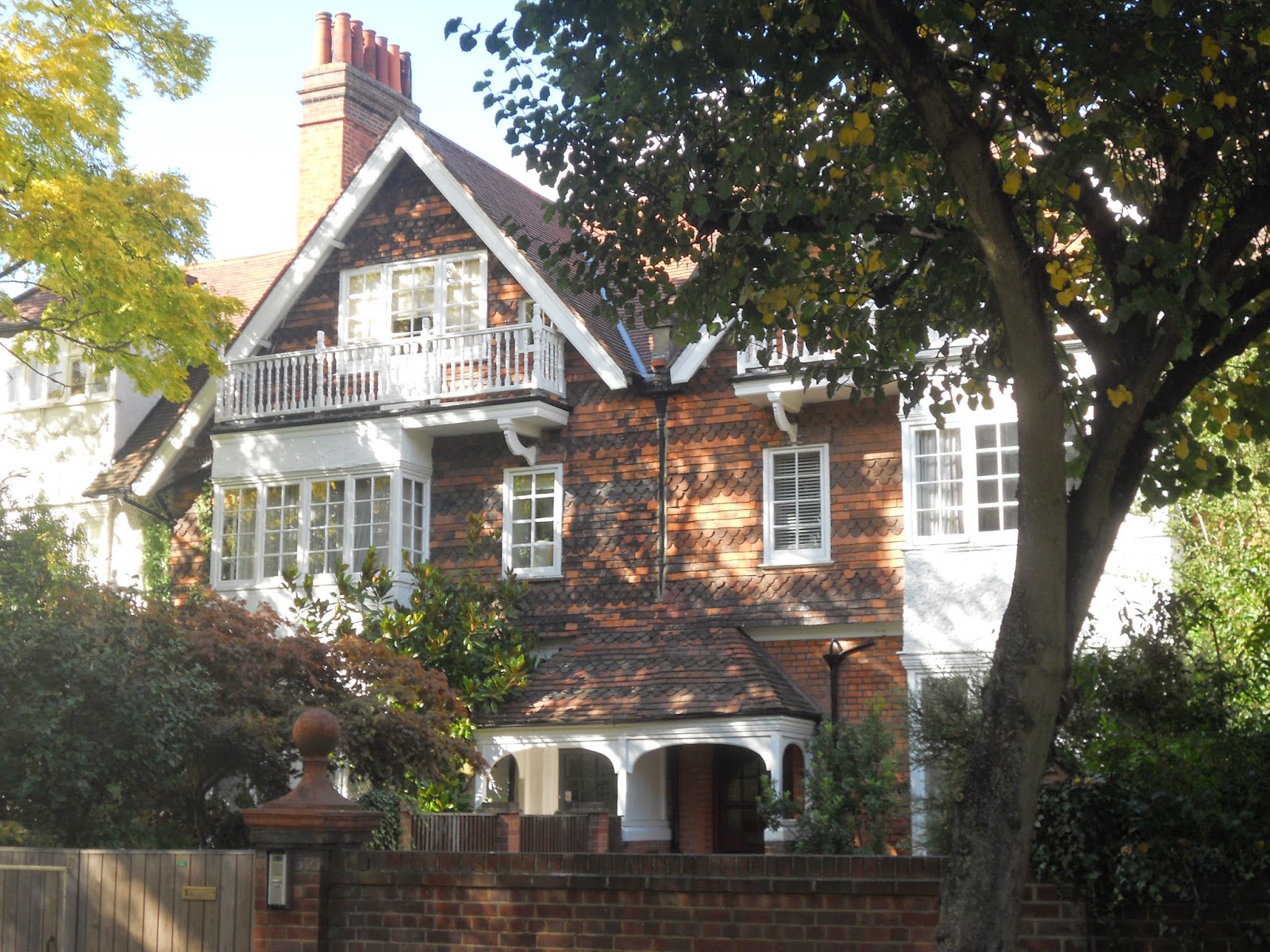
Large areas of green land has been preserved quite close to the city centre.  A good example of this would be Christchurch Meadows.


Oxford’s Science Park can be found on the edge of the city. Its presence is signified by a large black building visible from the A4074. Much of its layout follows the familiar pavilions-in-the-park  type theme.  Although such developments have become ubiquitous in Britain in recent decades, the landscape strategy clearly attempts to respond to the specific as opposed to generic qualities of the site. Many of the buildings are orientated towards Littlemore Brook which is provided with a riverside walk.


Most the Science Park’s  streets are  devoid of any pedestrian life.


Extraordinary resources have been lavished in landscaping  car parking spaces.

Although the development has been provided with gymnasium plus café it is doubtful whether this can be really considered to be a mixed-use development.

There has been much discussion over the appropriate form the next wave of British urban development should take. An approach which I think has much potential is that of the retrofit. A business park such as this could be seen as the nucleus of new neighbourhoods as opposed to mono-functional zones. The thinking behind the business park presumably is that the tranquility necessary for work is only possible in buildings separate from city centres, surrounded by countryside. The example of Oxford city centre shows that very private activities such as teaching facilities, libraries and halls of residence can be successfully incorporated into a city centre.

An intellectual like Paul Virilio has often argued that settlement patterns are often determined by transportation patterns. The car-based convenience of the business park can be contrasted with the transport strategy of a historic city such as  Oxford where visitors  usually use park and ride  facilities, leaving their cars on the outskirts of the city to make their journey into the city centre by bus. The challenge to urban designers  is to produce the urban environments of the future where the environment is of such high quality that people will actually be prepared to give up their cars or at least accept a greatly reduced role for them. Perhaps the business people of the future will adopt the practice of Oxford students who often cycle to work.


The expansion of a  city like Oxford might provide an ideal site for growth to solve Britain’s  housing shortage. A site such as Oxford Science park could have  housing developments  built next to them together with some retrofitting of the office buildings into more mixed-use functions.

Another strategic criteria for town expansion is the issue of city size.  The Garden City and  New Town Movements always proposed that cities should only be allowed to reach a certain size and that somewhere between 33,000 to 200,000 was the optimum size for a city. Obviously Oxford would fulfil this criteria. The site is several miles from the city centre, separated by many “green breaks”.

Lancelot  ”Capability”  Brown  acquired his nickname through his habit of telling his clients that their sites had  great “capabilities.” Surely a site like Oxford Science Park has the capability  to provide a starting  point for a mixed-use expansion of Oxford.


( Thanks to Google for aerial view of river Cherwell)