Showing posts with label City Size. Show all posts

Saturday, 11 April 2015

Urbino & London; Italian lessons and British Context


“Make of a house a small city and of a city a large house”
Attributed to Alberti and Aldo Van Eyck


The city of Urbino in Marche, Italy is often taken to be perhaps  the perfect Renaissance city. The architectural highlights of this city include the Ducal Palace, with its courtyard by Bramante, the Duomo Cathedral and the Sanzio Theatre with its subterranean ramp.   This is a walled, multi-levelled city. You enter through one of the city gates ( three or four I recall) ascending a steeply inclined street/ramp. This leads you through the city fabric to the two main  piazzas of the city from where you can visit the main city monuments.


                                                Plan of Urbino


Urbino  establishes an almost perfect balance between architecture and nature. Everyone who lives inside it lives in an apartment with no access to a personally owned garden. However, residents  can easily walk into the surrounding countryside. When we look at a plan it is clear that the overall footprint of the walled historic city is about 400m by 1000m. A person walking at 3 miles an hour covers almost exactly 400m in five minutes. Hence the  journey time a pedestrian will take to reach the countryside will only be in a matter of five or ten minutes. Despite the fact that, in its overall footprint, it is approximately the size of an English village, it feels like a city, largely due to its buildings being four to six stories high.  For various reasons, probably largely economic, it never grew as a city. Its high density environment has remained largely unchanged exuding a strong feeling of being frozen in time. After the last war a decision was taken to greatly expand the university leading to the appointment of the architect Giancarlo de Carlo in 1956. Some of the city centre buildings have been converted to academic uses. A large cluster of academic buildings have been created on the other side of the next hill.


It is illuminating to compare the example of Urbino with  London. Going back to the example of Urbino, we can see that London once occupied a similarly scaled footprint, when it’s size did not much exceed its Roman/Medieval boundaries. When it began to expand, at first basically into Westminster, the pattern of growth began to change. The growth of London can  illustrated by showing precise maps at different stages in its development.


           London during the time of Queen Elizabeth I (Reign 1558-1603) 


Queen Elizabeth I tried to limit the growth of London by issuing a proclamation in 1580  forbidding  the construction of any new buildings within 3 miles of the city walls and also established the principle that no more than one family should live in each house.  In her time, London meant what is now basically perceived as the City of London, what is now the  financial district, plus a small part of Southwark. The demographics of London meant that this decree was eventually unenforceable. West London, what is today Westminster, was the home to many estates owned by aristocrats, convents and monasteries, hospitals and lawyers i.e. important  households set in mostly open land. Gradually, bit by bit, this land was developed into the built fabric of London we see today. The Monarch’s attempts to control development did bear  fruit in the sense that the Government established a system whereby developments could only go ahead if a licence was granted, prefiguring today’s  planning system. A license was often only granted if a development was seen as being of sufficiently high quality.  For example, in the case of Saint James, the estate was divided up;  the Tudor palace of St James was preserved along with a small amount of open land, what today is St James Park. An enterprising developer, the Earl of St Albans was allowed to develop the northern part of the estate  into a mixed-use neighbourhood comprising a square, housing and eventually the church of St James in Piccadilly designed by Sir Christopher Wren. This, in fact, was the pattern of development for the expansion of London: neighbourhoods  with a mixture of uses i.e. some housing plus other functions such as a church or market and  including some open land. This polycentric pattern of growth ultimately culminated, in the context of the 18th Century,  in  the Georgian city of the Hanoverians recorded in  John Rocque’s plan of London.


                                   John Rocque’s plan of London in 1746


The ancient City of London had virtually no green space within its boundaries. It did not need to, being so small. Seeing that its street pattern has never really changed, this absence of green space remains even today. As the great estates of west London were built on, it was always felt wise to reserve some of the green space as a park. This is the ultimate origin of west London’s great series of parks.

We are used to seeing sections through  buildings and even cities to illustrate how spaces relate to each other. We also need sections through peoples’  lives to see the dwellings and towns or cities they choose to live in at that  point in their lives. When I visited New York I remember talking to someone who described the life pattern of many young Americans. They live in an apartment when young but latter, when they are often married with children, they choose to move away to a house with a garden. It is also worth remarking how an area like the City of London has almost entirely changed over the centuries from a mixed-use neighbourhood, where people lived as well as worked, to an almost entirely mono-functional area consisting of offices. Perhaps this can be taken as a classic symptom of a city which has been allowed to become too big. There are, of course, developments such as The Barbican which might be taken as an attempt to re-introduce mixed-use back into the City of London. Perhaps the most obvious lesson is, to return to the quotation which began this piece, is that high density works best when a city is at quite a small scale.

The Georgian city recorded in John Rocque’s plan did not, of course, mark the end of the city’s growth. If a city’s growth patterns are formed by its transportation patterns then, of course, further plans could be presented:  the age of the railways, i.e. the Victorian age and the age of the early motor car, i.e. the 1930’s leading up Patrick Abercrombie’s plan of 1945; the decision to limit the growth of London by a green belt and direct new growth to eight satellite towns.

What lessons can be learnt  here on the subject of a city’s growth?  Firstly, it is clear that a city grows in a process similar to cellular sub-division. New neighbourhoods are added to existing neighbourhoods. What constitutes a neighbourhood might be understood as an area with a mixture of uses which can be easily traversed. In the age of Urbino it was determined by the walking distance of a pedestrian. The lesson here is that man as the measure of all things i.e. the pedestrian scale, is the correct scale by which to gauge the development of the polycentric city. It is also true that attempts to mitigate the effects of excessive urbanism by the use of the typology of the house with garden can be inadequate. The third lesson might be that it is possible to argue that an excessively urban design environment cannot be mitigated by  more neighbourhoods with this type of the housing and that to the lessons of mixed-use and pedestrian scale  must be added the notion that the entire size of a   city can actually be allowed to become too big.


Clearly the growth of a city can be seen as requiring a major strategic rethink once it has acquired a certain size. What is needed is a solution that goes beyond simply more houses with gardens. Offering suburbia as a solution to the problem of city growth can be rather simplistic.  In itself suburbia does not really constitute an urban design proposal since it only deals with one function of the city, housing. The early urban design proposals of Le Corbusier may have been ludicrously simplistic, no more than over-scaled diagrams. However, Le Corbusier did reduce a city to simply four functions and not just one. The Athens Charter included work, leisure and circulation along with housing as the four basic functions of the city.


In this description of the growth of London, I am indebted to Rasmussen’s book, “London: The Unique City,” possibly the finest book ever written on the growth of a city and certainly, in my view, perhaps the finest book on London. All I can say is read it in its entirety.

(Thanks to Rob Bourke for plan of Urbino.  All other images are either by author,have had copyright ownership traced as far as possible or believed to be in public domain )

Thursday, 19 March 2015

The Achievement of Peter Hall


It is almost impossible to summarise the achievement of Peter Hall. Many have only read a small proportion of his vast written output but his importance as an urban designer cannot be doubted, a designer who worked not with images but with words.  This is clear even if you have read no more than three of his books.
Peter Hall fulfilled many important roles such as the President of Town and Country Planning Association  and Professor of Planning at The Bartlett, University College, London.    Yet what was his achievement? He was both theorist and practitioner, authoring   over 50 books on planning and acting as advisor to successive British  governments. 


                          Peter Hall on a TCPA trip to Denmark


Although he was a brilliant, and in many ways original urban designer, he thought it important to attribute a  genealogy of urban design theory. In his book “Cities of Tomorrow”, perhaps the most important work on planning published in five decades or so, he seemed to regard one single source as pre-eminent.

It is invidious, but it needs saying: despite doughty competition, Ebenezer Howard ( 1850-1928) is the most important single character in this entire tale.

The history of the origins, growth and development of British Cities  is too complicated to sketch out here, beginning with its origins in Roman/Medieval times or perhaps even earlier. In the view of  Peter Hall, the discipline of planning evolved as a response to the blind growth of cities which took place in the Nineteenth Century:

Victorian Britain regarded the problems of the inner cities as the “the one great domestic problem which the religion, the humanity, and the statesmanship of England are imperatively summoned to solve.”

No one who has studied the state of Victorian slums could doubt that the Nineteenth century produced cities unfit for human habitation. And unfit in so many ways. As well as poor access to medical services, education and employment a central part of the problem was  poor housing. This has to be understood in many senses including the urban/strategic sense.


                      High density horror: with its inadequate light-wells,
                      this example shows what architecture can be reduced to
                      without the interventions of legislation.


It has been well established that cities which do not encourage people to walk will produce unhealthy people. It has also been established that patients in hospitals can be partly nurtured to recovery by the sight of trees and sunlight. There is a third factor that might be identified. Peter Hall, in his book Cities of Tomorrow,  observed that cities, in the form unfettered growth had allowed them to take, can also be diametrical to health.

There was an interesting reaction to growth and overcrowding in the European capitals: both in London and in Berlin, fears began to develop that the city population was in some way biologically unfit. Around 1900, recruitment for the South African War exposed the fact that out of 11,000 young men in Manchester, 8000 were rejected and only 1,000 were fit for regular service. Later, in World War One, the Verney Commission reasserted that the physique of the urban part of Britain tended to deteriorate and was maintained only by recruitment from the countryside. Similarly, in Berlin, only 42 percent of Berliners were found fit for army service in 1913, against 66 percent of those from rural areas


It is depressing to think that war was  a  major impetus in forcing the holders of political power to rethink their attitudes to urban design but as the above passage makes clear, it does seem to be the case. Necessity is the mother of virtue and whether or not politicians thought better urban design was a matter of national survival is hardly the point. Attitudes to urban design did change.


                         "Homes fit for Heroes" was a key issue in
                         the 1918 election. Perhaps "Homes fit for
                         Workers" might prove a suitable rallying cry today.


This is the point at which Peter Hall’s narrative on planning really kicks off. If cities were not to be ruinous to people’s health, lessons would have to be learnt regarding why people from the countryside were in better health than those from the cities. The lessons learnt were felt to be numerous. It was felt that cities could be allowed to become too big. Agricultural workers were no more involved in manual labour than industrial workers so exercise was not a key factor. Agricultural workers do tend to live in small urban conglomerations i.e. villages. Villages established a strong connection with nature simply by virtue of their size, even if their inhabitants lived in apartments, no need to reinvent the typology of the house with garden here. Villages represented concentrations of built density  within the landscape ( see Frank Lloyd Wright’s Broadacre City for the anti-thesis to this approach). And so, city size was felt to be not a key component of urban design theory but THE key component.

This had huge implications. The growth of existing large cities was thought to be something that needed to be restrained i.e. the need for green belts was immediately felt. And its implications were widespread i.e. it was felt that  new growth should be directed towards satellite cities.

The influence of Ebenezer Howard runs like thread throughout the work  of Peter Hall, both as  theorist and practitioner. However, although he was  an urban designer who whilst acknowledging a generic source, he always managed to think in very site specific terms. In the 1960’s he embraced the fashionable political anarchism of the era by advocating planning-free zones. In the 1980’s he did almost the same thing by acting as an advisor to Margaret Thatcher’s government. London’s docklands are basically a testament to this. Yet although he was capable of embracing planning-free zones, largely due to a sense of political realism I suspect, his heart I always thought, was in order not chaos. It is doubtful whether if , in recent decades, there was a single planning problem, from inner-city regeneration to Thames estuary airports, on which he was not consulted. He acted as  part of the team that produced the Urban Task Force report, chaired by Lord Richard Rogers. He probably knew more about planning than anyone else alive.

As I lay these verbal flowers upon his grave, I imagine some of my readers are thinking: why are you telling us things we already know? Why not tell us something original?        
                                    
I was lucky enough to meet him once at a lecture I attended entitled  “Object vs City;” this debate which took place some time ago (2008) when I managed to put questions to both protagonists in the debate, Peter Hall and Will Alsop. The debate took place in a fairly traditional format with both participants making an opening statement followed by questions from the floor. The opening statements took the form largely of two images each participant chose to present. I recall that Will Alsop chose to present a photograph taken on his iphone of a Frank Gehry building in New York. The man chairing the debate, Hank Dittmar, presented some of his own images and these staked out a position quite similar to that advocated by Peter  Hall. They spoke of the ideals of Ebenezer Howard and the sort of places I have illustrated in my own photographs such as Hampstead Garden Suburb.


The lecture covered fairly familiar ground, complete  with a reference to Howard’s three magnets diagram without which, it seemed, no Peter Hall lecture was complete.  Since the main subject was the possible synthesis between architecture and planning, Peter Hall turned his attention to his recollections of his time as a guest critic of student projects at the architecture department in The Bartlett. His reminisces proved quite a criticism of the state of architectural education:  

We look at the architectural students proposals which we don’t understand. They don’t understand our ideas either.


                                      Projects by Will Alsop


Will Alsop spoke about therapeutic drawing projects he had developed with mentally handicapped people. The most interesting part of the discussion was when the discussion was opened up to questions from the floor. I asked the following question which I quote from memory:

The most basic spatial unit  of urban design seems to be the neighbourhood which can be added to culminating in a polycentric city. Ebenezer Howard’s most basic idea was that the growth of cities, the accumulation of further neighbourhoods, must at some point be arrested. A green belt  must be laid down and further growth directed to satellite towns. Could the government’s Eco-Town initiative be seen as a contemporary expression of this?

Peter Hall started his reply by stating that:

I could talk about this for a couple of hours.

It was, I admit, something of a rhetorical question since I had imagined Peter Hall would be in his element answering this. The venue was filled, it seemed, largely with architectural students who seemed to understand little about the subject so perhaps a rhetorical question was needed; Peter Hall managed to sketch out, within the space of a few minutes, many of the ideas that had been derived from Ebenezer Howard. Planning theory had indeed developed since this period. Ideas such as satellite towns now seemed somewhat dated, they were now viewed as mixed-use nodes, indeed the ideas of Ebenezer Howard could be seen as the basis of regional planning with only a few exceptions ( See Patrick Geddes).  Peter Hall was broadly supportive of the eco-town initiative, indeed it seemed it the fulfilment of many of the ideas he had long been arguing for. Of course, this was only one of the approaches to planning advocated. I remember talking to him about Woking and how it been expanded. Peter Hall practiced what he preached. He never argued that satellite garden cities were the solution to all urban design problems. Whilst some planning lecturers at The Bartlett chose to commute in every day from Milton Keynes, he chose to live in London. 

Peter Hall viewed the future of planning, at any rate in Britain, with a degree of pessimism. One of his last essays was entitled “The Strange Death of Planning.” He viewed planners not as purveyors of  some sort of aesthetic frippery but as essential problem solvers. In Britain they were, however, “prophets without honour,” i.e. their contributions were simply ignored by those in power. They had vital insights to offer; they knew that badly designed sprawl would result in vast consumption of non-renewable resources. They knew that excessively built up areas could lead to bad health.  Only intelligent planning could resolve the seemingly antithetical demands of city dwellers. Other  countries were well positioned to take advantage of the post-oil economies we would soon be embracing whereas Britain would not. Other countries might have happy, healthy workforces whereas we might not.  In short, Peter Hall, realised that  good urban design was not something superficial but perhaps even a matter of national survival. 

When he died, his colleague on the Urban Task Force, Lord Richard Rogers paid tribute to him with the following generous words:

Peter Hall was a great humanist and the most important planner in post-war Britain with a wide knowledge of the nature of cities around the world.
 I had lunch with him only a few of weeks ago where we discussed the best examples of cities in Europe, a subject brilliantly covered by his last book ‘Good Cities, Better Lives’.

 I got to  know him well when I chaired the Urban Task Force where his advice was indispensable.  There was only one area where we had a disagreement - his argument for garden cities and my belief in the compact city as the only sustainable way to accommodate growth - but he was as civilised in disagreement as he was in agreement.  His continuing commitment to the garden cities movement was reflected in his writings on the legacy of Ebenezer Howard, and in his presidency of the Town and Country Planning Association, but his interests and scholarship ranged far wider.  
He was an inspiring colleague, a good friend and is truly a great loss to the profession.


               Basingstoke, though often mistaken for a "New Town" is
               actually a greatly expanded existing town. These "Urban
               Renaissance" high-density housing units have fundamentally
               changed the fabric of Basingstoke, probably for the better.


I re-established contact with Peter Hall at the time of the Wolfson Prize on Economics for garden Cities. I had plenty of ideas of my own on the subject of garden cities but felt I did not understand enough about the economics of the subject. It was widely agreed that the rise in land values had to be captured for the benefit of the community but, over and beyond that, I felt a more nuanced approach was necessary. I asked him for advice on a reading list on the subject but his advice was less than forthcoming since he told me that he was planning to enter the same competition himself.

Still, there was a remarkable convergence of ideas in the Wolfson Prize, a convergence which was achieved without conferring. Nearly all the prize-winning entries (and mine) had one idea in common; whilst the “Urban Renaissance” had achieved many things, density in places like London had been taken as far as it could go. Building on the Green Belt was not the answer. Neither was it necessary to consider a series of New Towns, similar to that achieved in the 1950’s and 1960’s. The answer might lie in expanding small to medium existing towns. This could be achieved in many ways. It might not even be necessary to consider enlarging the footprint of existing cities i.e. I suggested converting Oxford’s business park into a mixed-use neighbourhood complete with a tram linking it to the centre.

Some of Peter Hall’s predictions and warnings  have arguably been vindicated. The Independent newspaper published a piece entitled “Victorian Diseases: Back from the dead” which tended to confirm his views on the likely health consequences of over-crowding in the inner cities. Peter Hall was opposed to sprawl and felt that only public transport could structure cities. Since British governments have declined to take much of a role in public transport, only private initiatives could provide public transport infrastructure ( see again The Independent) in the form of developments such as the new Reading station and HS2. It remains to be seen whether these will suffice to make  the necessarily vital contribution that mass-transit makes to urban design.

Peter Hall occupied an absolutely key role in the British  debate on planning  Moreover, he was that rarest of things, a planner who did not hide behind obscure jargon but who made the effort to communicate with the public, writing in clear English. Now that he’s gone, of course,  the torch has been passed to new generation.


(Thanks to  Wiley for  quotations from “Cities of Tomorrow” © 1988, 1996, 2002 by Peter Hall. Also thanks to Thanks to TCPA for photo of Peter Hall, ALL-Design for Will Alsop images, RSH for Rogers quotation. All other images  are either by author,have had copyright ownership traced as far as possible or believed to be in public domain)


Sunday, 4 May 2014

The British Garden City Movement: Bedford Park


Jane Jacobs attacked the Garden City movement when she stated that “its prescription for saving the city was to do the city in.” Was this criticism justified? Well, the answer is surely yes and no. Firstly, the original Garden City movement was an attempt to deal  with the growth of existing cities by proposing satellite communities. The size of existing cities would be limited by green belts. These would help  define a city’s  size, maintain a balance between city and country and by forcing new developments into existing sites in a city  act as a catalyst for urban regeneration.

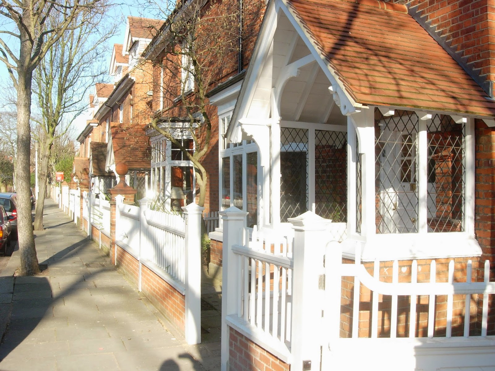
The idea of satellites was basically an offshoot of its concern about  the issue of city size. Bedford Park, in west London, is often taken as a good example of the Garden City Movement though its proximity to central London ensures it should really be viewed as a neighbourhood of an existing city rather than a true satellite.
An important fact about Bedford Park is the date of its founding, 1875, which gives it some claim to be the origin of the Garden City Movement.

The development is often viewed as the work of Richard Norman Shaw although Shaw was actually the second architect to be appointed by the client, Jonathan Carr. Other architects who worked on the development included Edward W Godwin, Maurice Adams and EJ May.


The development is centred around Acton Green Common and the adjacent Turnham Green  tube station. Here are the non-residential uses such as parade of shops, church and pub. 


Shaw was  responsible for buildings which compromise centre pieces of the development such as St Michael &  All Angels Church  and  the Tabard Pub.


                                     Shops on The South Parade.

A series of residential streets fan out from this heart of the community.


                                                     Priory Gardens


The houses by Shaw at 22 Woodstock Road  are surprisingly not the best in the development.


High density housing has been allowed on part of the site.

Richard Norman Shaw is remembered as one of the most eclectic architects of the Nineteenth Century, responsible for buildings such as New Scotland Yard  on the Thames Embankment and the less interesting Piccadilly  Hotel.

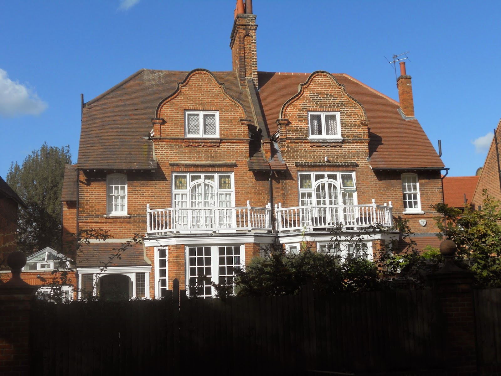
Much of the development has been designed in what became known as The Queen Anne Style.   It is something of a historical curiosity that Richard Norman Shaw, a   half-Irish, half-Scottish architect should devote his career to this English, or to be more precise, Dutch style of architecture.

Dutch motifs such as bell gables can be found throughout the development. Many of these houses are not actually by Shaw himself.


Should this approach be regarded  as something simply producing surface effects rather than any deeper, spatial qualities, the sort of criticism sometimes leveled at the  work of John Nash? Well, to give an informed answer to that question I would have to have seen more Shaw interiors and I can only recall visiting the interior of two buildings by  Shaw ,  Swan House on Chelsea Embankment and The Royal Geographical Society in South Kensington and  both indeed provided a memorable experience.


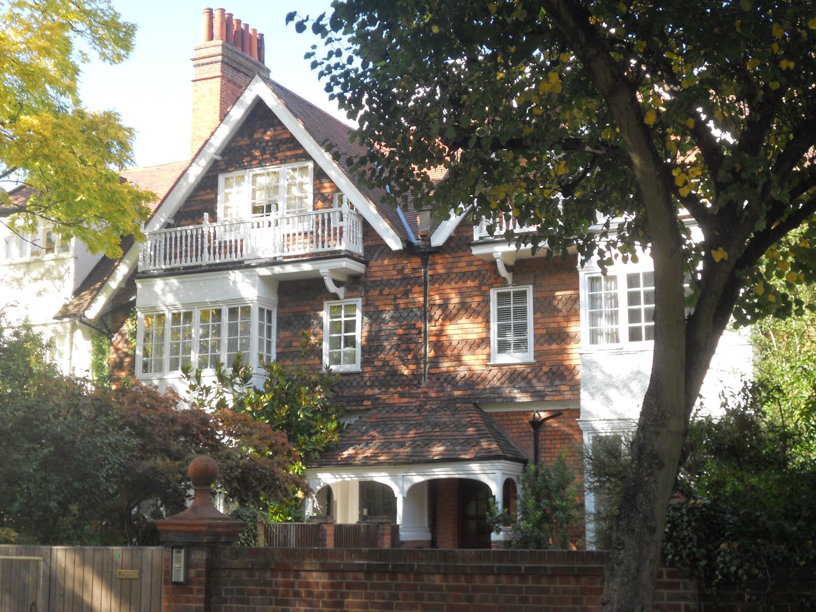
At any rate, the development contains some of the prettiest houses in London.


The development has provided a home for famous residents such as W.B. Yeats, Camille Pissarro and, in more recent years, John Humphrys of the  BBC. It also appeared in the  G.K. Chesterton novel The Man who was Thursday under the name Saffron Park.

It is true that the garden City movement as conceived by Ebenezer Howard had little to say about existing cities and hence offers little guidance on issues such as the regeneration of inner-city  sites. It that sense, it cannot be said to be a comprehensive theory of urban design. Its concern for issues such as city size and satellites did evince an ability  to think in regions, something often sadly amiss from today’s thinking on urban design.

Monday, 7 April 2014

Cambridge’s Unique Green Belt


Cambridge has a unique green belt; unique in that it is actually embedded within the fabric of the city. It is possible ( well almost) to walk in a circular route through the city centre without straying from green land.


The sequence of spaces starts at the Fen’s Causeway which leads onto “The Backs”.


“The Backs” follow the route of the river Cam.


If you wish to vary this route, you can occasionally  venture into the city of Cambridge itself encountering streetscape of incredibly high quality.


The architecture and its detailing is  similarly astounding.


View from the Avenue, Trinity College.


St Giles Church at the intersection of Castle Street and Chesterton Lane.


Jesus Green.


Houses on Short Street.


Christ’s Pieces.


Parker’s Piece


Unlike Oxford, Cambridge’s  science park is not separated from the city by a strategic “green break”  but is located on the north of the city, within the boundary of the ring road.

It is perhaps for this reason that  a proposed satellite town, Northstowe, will be located five miles to the north-west  of Cambridge on a site between the villages of Oakington and Longstanton. This development is master-planned by Arups and it will be exciting to see how it turns out.

Thursday, 3 April 2014

Oxford Landscapes


The landscapes in and around Oxford provide, for me, ample food  for thought regarding approaches to urban design. Take this example, a view from Blenheim Palace, just north of Oxford. This naturalistic landscape has virtually nothing natural about it and was created to the designs of Capability Brown. A contrived landscape like this evokes many picturesque associations. When I see the island on the lake with its tall  Cyprus trees , like many I imagine, I am reminded of the painting  The Isle of the Dead by Arnold Brocklin.  A late Romantic like Arnold Bocklin was simply referring back to the picturesque tradition, a tradition which predates Capability Brown himself.


Landscapes like this and similar landscapes like Stowe are often taken as the pinnacles of British landscape design. Personally, however, I would rather be in Oxford itself. Surely a city like this provides the ultimate example of  a garden city, a city where landscape has been married to architecture to produce perhaps the most delightful, liveable city in the UK.

The Botanic Gardens, the grounds of Christ Church College, Port Meadows, the University Parks together with ten of the college gardens are on the national list of historic parks and gardens. In all, there are 417 gardens and parks  within the boundary of the City of Oxford which are usually accessible to the public. 52% of the land within the city is green land.


As you move through the fabric of Oxford, you become aware of what seems like a basically urban spectacle.


Only when you get closer to buildings do you become aware of another dimension. Vistas open out to reveal extraordinary natural landscaping such as the grounds of Trinity College.


A landscape replete with routes and incidents. 


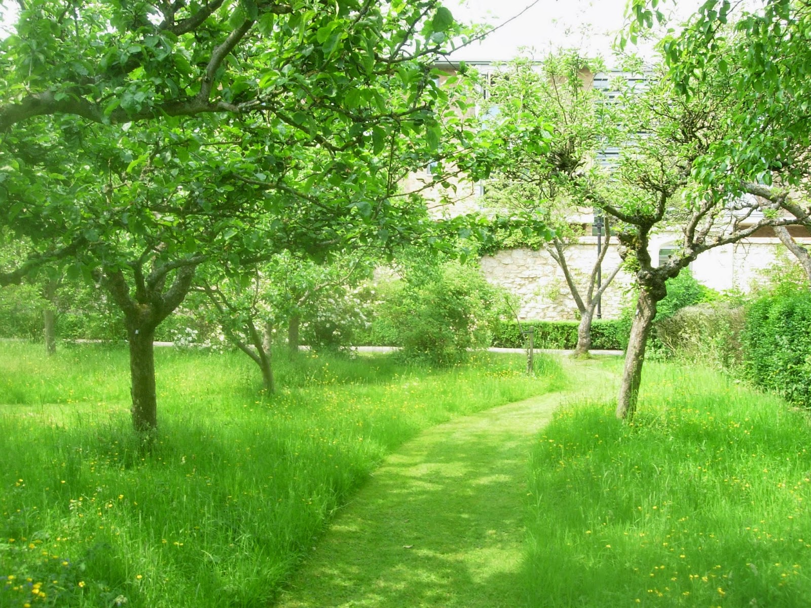
Worcester College incorporates an orchard within its grounds.


Cars are almost entirely banned from the centre of Oxford. This allows streets to be appropriated in the summer for cafes. Park and ride facilities allow motorists to park at the edge of the city and take public transport into the centre.


Bike lanes have been provided throughout the city.


The city’s name refers to its origins as a fording place on a river. The city is sited around the confluence of two rivers, The river Isis  (Thames)  and Cherwell. These, together with the Oxford canal have created ample opportunity to create linear parks.


The Oxford canal on the right with the Isis (Thames) to the left.


The river Cherwell resembles an Indian river in that it seems to have two river beds. Its flood plain creates a linear park in the centre of the city.


Privacy is allowed in the college grounds by the simple device of the railing. This allows views in but prevents straying members of the public wandering in.


An additional   level of privacy is created by the simple device of the wall used to enclose   the famous quadrangles.


Large areas of green land has been preserved quite close to the city centre.  A good example of this would be Christchurch Meadows.


Oxford’s Science Park can be found on the edge of the city. Its presence is signified by a large black building visible from the A4074. Much of its layout follows the familiar pavilions-in-the-park  type theme.  Although such developments have become ubiquitous in Britain in recent decades, the landscape strategy clearly attempts to respond to the specific as opposed to generic qualities of the site. Many of the buildings are orientated towards Littlemore Brook which is provided with a riverside walk.


Most the Science Park’s  streets are  devoid of any pedestrian life.


Extraordinary resources have been lavished in landscaping  car parking spaces.

Although the development has been provided with gymnasium plus café it is doubtful whether this can be really considered to be a mixed-use development.

There has been much discussion over the appropriate form the next wave of British urban development should take. An approach which I think has much potential is that of the retrofit. A business park such as this could be seen as the nucleus of new neighbourhoods as opposed to mono-functional zones. The thinking behind the business park presumably is that the tranquility necessary for work is only possible in buildings separate from city centres, surrounded by countryside. The example of Oxford city centre shows that very private activities such as teaching facilities, libraries and halls of residence can be successfully incorporated into a city centre.

An intellectual like Paul Virilio has often argued that settlement patterns are often determined by transportation patterns. The car-based convenience of the business park can be contrasted with the transport strategy of a historic city such as  Oxford where visitors  usually use park and ride  facilities, leaving their cars on the outskirts of the city to make their journey into the city centre by bus. The challenge to urban designers  is to produce the urban environments of the future where the environment is of such high quality that people will actually be prepared to give up their cars or at least accept a greatly reduced role for them. Perhaps the business people of the future will adopt the practice of Oxford students who often cycle to work.


The expansion of a  city like Oxford might provide an ideal site for growth to solve Britain’s  housing shortage. A site such as Oxford Science park could have  housing developments  built next to them together with some retrofitting of the office buildings into more mixed-use functions.

Another strategic criteria for town expansion is the issue of city size.  The Garden City and  New Town Movements always proposed that cities should only be allowed to reach a certain size and that somewhere between 33,000 to 200,000 was the optimum size for a city. Obviously Oxford would fulfil this criteria. The site is several miles from the city centre, separated by many “green breaks”.

Lancelot  ”Capability”  Brown  acquired his nickname through his habit of telling his clients that their sites had  great “capabilities.” Surely a site like Oxford Science Park has the capability  to provide a starting  point for a mixed-use expansion of Oxford.


( Thanks to Google for aerial view of river Cherwell)