Showing posts with label Neighbourhood. Show all posts

Saturday, 11 April 2015

Urbino & London; Italian lessons and British Context


“Make of a house a small city and of a city a large house”
Attributed to Alberti and Aldo Van Eyck


The city of Urbino in Marche, Italy is often taken to be perhaps  the perfect Renaissance city. The architectural highlights of this city include the Ducal Palace, with its courtyard by Bramante, the Duomo Cathedral and the Sanzio Theatre with its subterranean ramp.   This is a walled, multi-levelled city. You enter through one of the city gates ( three or four I recall) ascending a steeply inclined street/ramp. This leads you through the city fabric to the two main  piazzas of the city from where you can visit the main city monuments.


                                                Plan of Urbino


Urbino  establishes an almost perfect balance between architecture and nature. Everyone who lives inside it lives in an apartment with no access to a personally owned garden. However, residents  can easily walk into the surrounding countryside. When we look at a plan it is clear that the overall footprint of the walled historic city is about 400m by 1000m. A person walking at 3 miles an hour covers almost exactly 400m in five minutes. Hence the  journey time a pedestrian will take to reach the countryside will only be in a matter of five or ten minutes. Despite the fact that, in its overall footprint, it is approximately the size of an English village, it feels like a city, largely due to its buildings being four to six stories high.  For various reasons, probably largely economic, it never grew as a city. Its high density environment has remained largely unchanged exuding a strong feeling of being frozen in time. After the last war a decision was taken to greatly expand the university leading to the appointment of the architect Giancarlo de Carlo in 1956. Some of the city centre buildings have been converted to academic uses. A large cluster of academic buildings have been created on the other side of the next hill.


It is illuminating to compare the example of Urbino with  London. Going back to the example of Urbino, we can see that London once occupied a similarly scaled footprint, when it’s size did not much exceed its Roman/Medieval boundaries. When it began to expand, at first basically into Westminster, the pattern of growth began to change. The growth of London can  illustrated by showing precise maps at different stages in its development.


           London during the time of Queen Elizabeth I (Reign 1558-1603) 


Queen Elizabeth I tried to limit the growth of London by issuing a proclamation in 1580  forbidding  the construction of any new buildings within 3 miles of the city walls and also established the principle that no more than one family should live in each house.  In her time, London meant what is now basically perceived as the City of London, what is now the  financial district, plus a small part of Southwark. The demographics of London meant that this decree was eventually unenforceable. West London, what is today Westminster, was the home to many estates owned by aristocrats, convents and monasteries, hospitals and lawyers i.e. important  households set in mostly open land. Gradually, bit by bit, this land was developed into the built fabric of London we see today. The Monarch’s attempts to control development did bear  fruit in the sense that the Government established a system whereby developments could only go ahead if a licence was granted, prefiguring today’s  planning system. A license was often only granted if a development was seen as being of sufficiently high quality.  For example, in the case of Saint James, the estate was divided up;  the Tudor palace of St James was preserved along with a small amount of open land, what today is St James Park. An enterprising developer, the Earl of St Albans was allowed to develop the northern part of the estate  into a mixed-use neighbourhood comprising a square, housing and eventually the church of St James in Piccadilly designed by Sir Christopher Wren. This, in fact, was the pattern of development for the expansion of London: neighbourhoods  with a mixture of uses i.e. some housing plus other functions such as a church or market and  including some open land. This polycentric pattern of growth ultimately culminated, in the context of the 18th Century,  in  the Georgian city of the Hanoverians recorded in  John Rocque’s plan of London.


                                   John Rocque’s plan of London in 1746


The ancient City of London had virtually no green space within its boundaries. It did not need to, being so small. Seeing that its street pattern has never really changed, this absence of green space remains even today. As the great estates of west London were built on, it was always felt wise to reserve some of the green space as a park. This is the ultimate origin of west London’s great series of parks.

We are used to seeing sections through  buildings and even cities to illustrate how spaces relate to each other. We also need sections through peoples’  lives to see the dwellings and towns or cities they choose to live in at that  point in their lives. When I visited New York I remember talking to someone who described the life pattern of many young Americans. They live in an apartment when young but latter, when they are often married with children, they choose to move away to a house with a garden. It is also worth remarking how an area like the City of London has almost entirely changed over the centuries from a mixed-use neighbourhood, where people lived as well as worked, to an almost entirely mono-functional area consisting of offices. Perhaps this can be taken as a classic symptom of a city which has been allowed to become too big. There are, of course, developments such as The Barbican which might be taken as an attempt to re-introduce mixed-use back into the City of London. Perhaps the most obvious lesson is, to return to the quotation which began this piece, is that high density works best when a city is at quite a small scale.

The Georgian city recorded in John Rocque’s plan did not, of course, mark the end of the city’s growth. If a city’s growth patterns are formed by its transportation patterns then, of course, further plans could be presented:  the age of the railways, i.e. the Victorian age and the age of the early motor car, i.e. the 1930’s leading up Patrick Abercrombie’s plan of 1945; the decision to limit the growth of London by a green belt and direct new growth to eight satellite towns.

What lessons can be learnt  here on the subject of a city’s growth?  Firstly, it is clear that a city grows in a process similar to cellular sub-division. New neighbourhoods are added to existing neighbourhoods. What constitutes a neighbourhood might be understood as an area with a mixture of uses which can be easily traversed. In the age of Urbino it was determined by the walking distance of a pedestrian. The lesson here is that man as the measure of all things i.e. the pedestrian scale, is the correct scale by which to gauge the development of the polycentric city. It is also true that attempts to mitigate the effects of excessive urbanism by the use of the typology of the house with garden can be inadequate. The third lesson might be that it is possible to argue that an excessively urban design environment cannot be mitigated by  more neighbourhoods with this type of the housing and that to the lessons of mixed-use and pedestrian scale  must be added the notion that the entire size of a   city can actually be allowed to become too big.


Clearly the growth of a city can be seen as requiring a major strategic rethink once it has acquired a certain size. What is needed is a solution that goes beyond simply more houses with gardens. Offering suburbia as a solution to the problem of city growth can be rather simplistic.  In itself suburbia does not really constitute an urban design proposal since it only deals with one function of the city, housing. The early urban design proposals of Le Corbusier may have been ludicrously simplistic, no more than over-scaled diagrams. However, Le Corbusier did reduce a city to simply four functions and not just one. The Athens Charter included work, leisure and circulation along with housing as the four basic functions of the city.


In this description of the growth of London, I am indebted to Rasmussen’s book, “London: The Unique City,” possibly the finest book ever written on the growth of a city and certainly, in my view, perhaps the finest book on London. All I can say is read it in its entirety.

(Thanks to Rob Bourke for plan of Urbino.  All other images are either by author,have had copyright ownership traced as far as possible or believed to be in public domain )

Sunday, 4 May 2014

The British Garden City Movement: Bedford Park


Jane Jacobs attacked the Garden City movement when she stated that “its prescription for saving the city was to do the city in.” Was this criticism justified? Well, the answer is surely yes and no. Firstly, the original Garden City movement was an attempt to deal  with the growth of existing cities by proposing satellite communities. The size of existing cities would be limited by green belts. These would help  define a city’s  size, maintain a balance between city and country and by forcing new developments into existing sites in a city  act as a catalyst for urban regeneration.

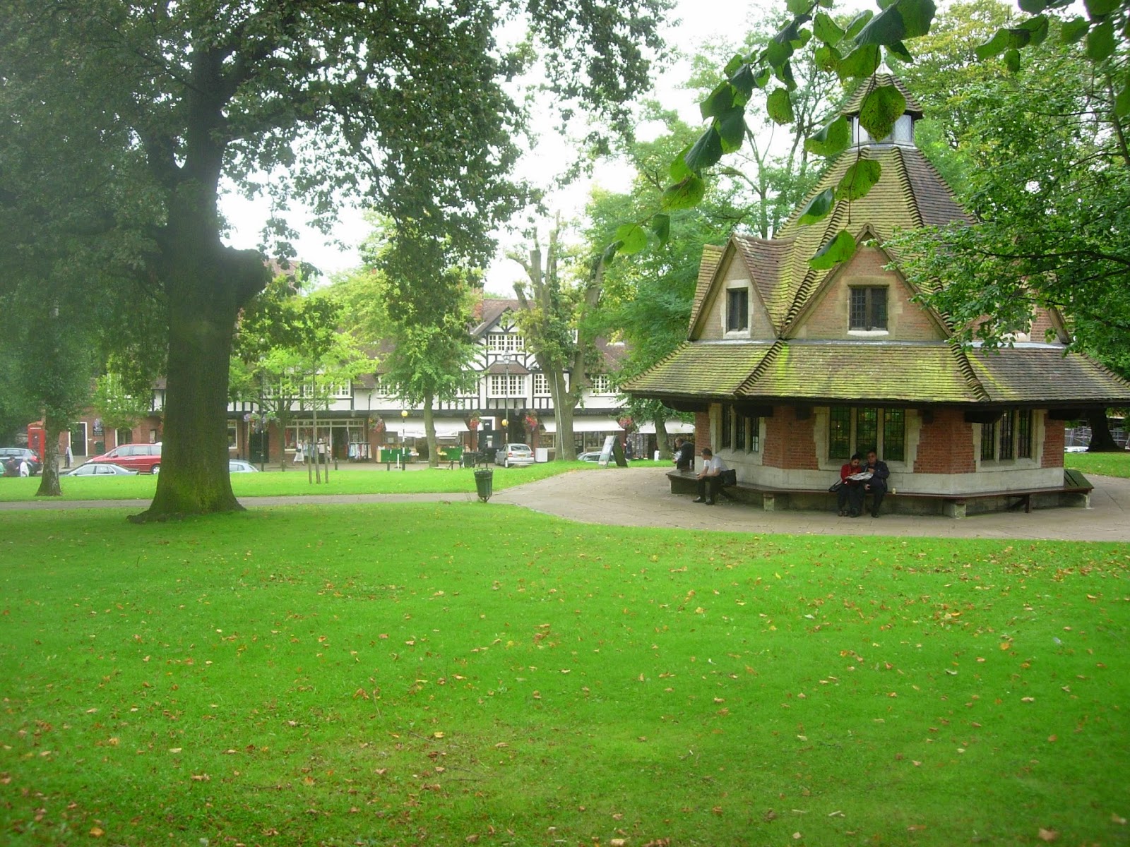
The idea of satellites was basically an offshoot of its concern about  the issue of city size. Bedford Park, in west London, is often taken as a good example of the Garden City Movement though its proximity to central London ensures it should really be viewed as a neighbourhood of an existing city rather than a true satellite.
An important fact about Bedford Park is the date of its founding, 1875, which gives it some claim to be the origin of the Garden City Movement.

The development is often viewed as the work of Richard Norman Shaw although Shaw was actually the second architect to be appointed by the client, Jonathan Carr. Other architects who worked on the development included Edward W Godwin, Maurice Adams and EJ May.


The development is centred around Acton Green Common and the adjacent Turnham Green  tube station. Here are the non-residential uses such as parade of shops, church and pub. 


Shaw was  responsible for buildings which compromise centre pieces of the development such as St Michael &  All Angels Church  and  the Tabard Pub.


                                     Shops on The South Parade.

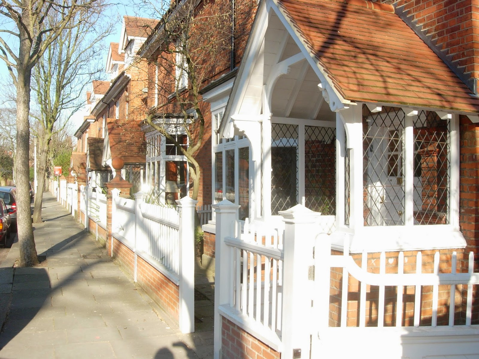
A series of residential streets fan out from this heart of the community.


                                                     Priory Gardens


The houses by Shaw at 22 Woodstock Road  are surprisingly not the best in the development.


High density housing has been allowed on part of the site.

Richard Norman Shaw is remembered as one of the most eclectic architects of the Nineteenth Century, responsible for buildings such as New Scotland Yard  on the Thames Embankment and the less interesting Piccadilly  Hotel.

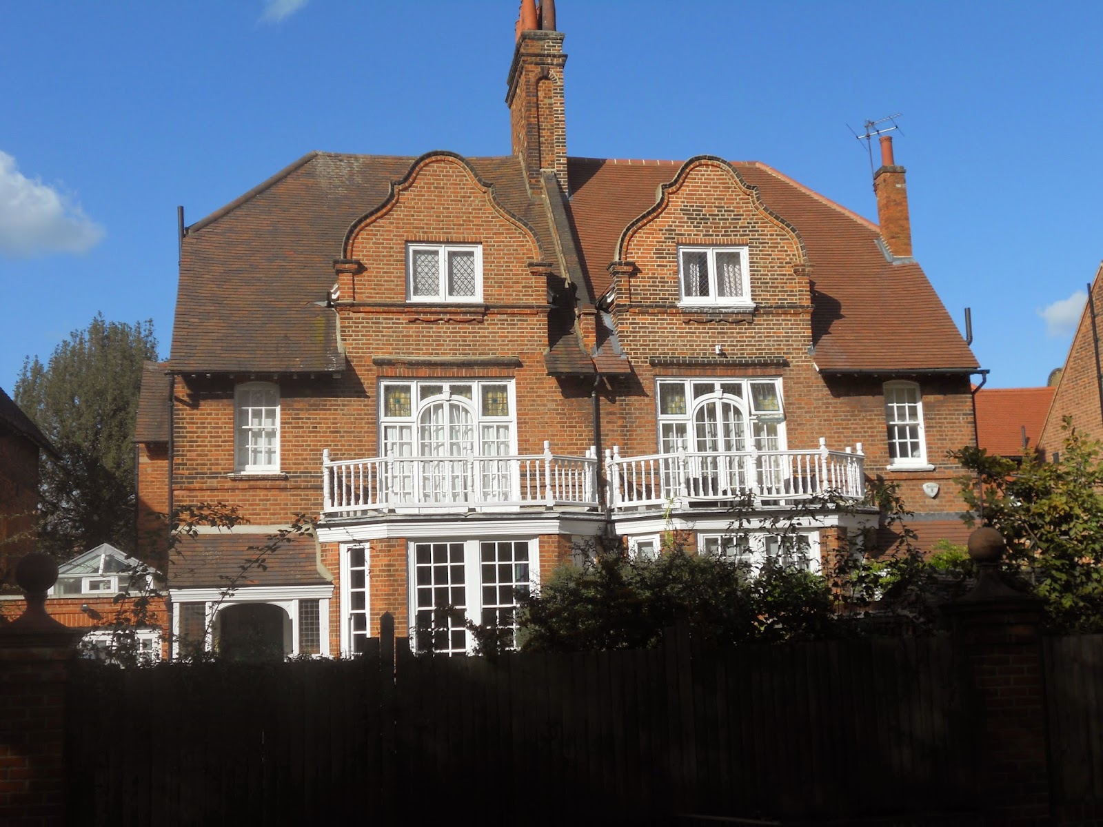
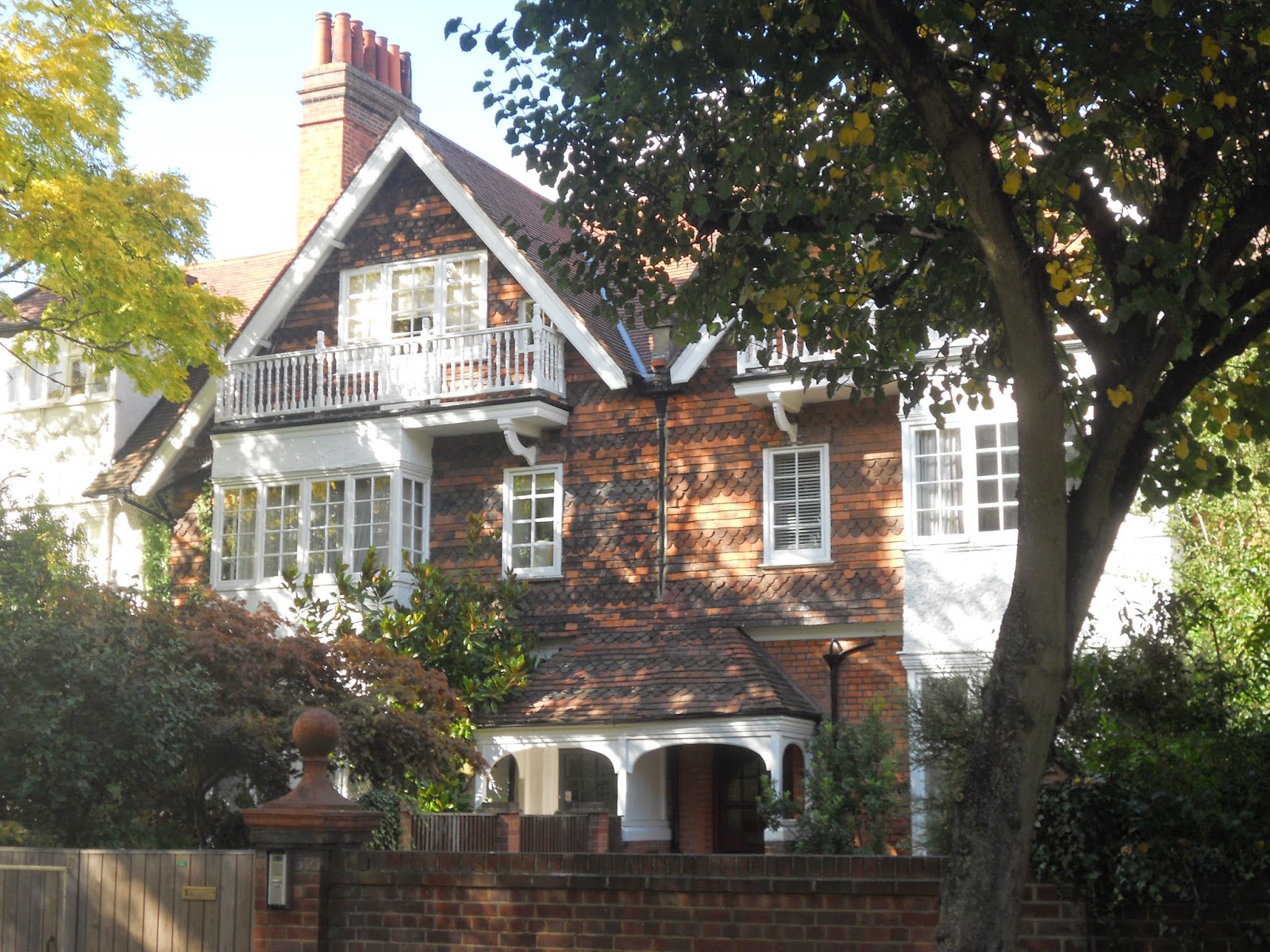
Much of the development has been designed in what became known as The Queen Anne Style.   It is something of a historical curiosity that Richard Norman Shaw, a   half-Irish, half-Scottish architect should devote his career to this English, or to be more precise, Dutch style of architecture.

Dutch motifs such as bell gables can be found throughout the development. Many of these houses are not actually by Shaw himself.


Should this approach be regarded  as something simply producing surface effects rather than any deeper, spatial qualities, the sort of criticism sometimes leveled at the  work of John Nash? Well, to give an informed answer to that question I would have to have seen more Shaw interiors and I can only recall visiting the interior of two buildings by  Shaw ,  Swan House on Chelsea Embankment and The Royal Geographical Society in South Kensington and  both indeed provided a memorable experience.


At any rate, the development contains some of the prettiest houses in London.


The development has provided a home for famous residents such as W.B. Yeats, Camille Pissarro and, in more recent years, John Humphrys of the  BBC. It also appeared in the  G.K. Chesterton novel The Man who was Thursday under the name Saffron Park.

It is true that the garden City movement as conceived by Ebenezer Howard had little to say about existing cities and hence offers little guidance on issues such as the regeneration of inner-city  sites. It that sense, it cannot be said to be a comprehensive theory of urban design. Its concern for issues such as city size and satellites did evince an ability  to think in regions, something often sadly amiss from today’s thinking on urban design.

Thursday, 3 April 2014

Oxford Landscapes


The landscapes in and around Oxford provide, for me, ample food  for thought regarding approaches to urban design. Take this example, a view from Blenheim Palace, just north of Oxford. This naturalistic landscape has virtually nothing natural about it and was created to the designs of Capability Brown. A contrived landscape like this evokes many picturesque associations. When I see the island on the lake with its tall  Cyprus trees , like many I imagine, I am reminded of the painting  The Isle of the Dead by Arnold Brocklin.  A late Romantic like Arnold Bocklin was simply referring back to the picturesque tradition, a tradition which predates Capability Brown himself.


Landscapes like this and similar landscapes like Stowe are often taken as the pinnacles of British landscape design. Personally, however, I would rather be in Oxford itself. Surely a city like this provides the ultimate example of  a garden city, a city where landscape has been married to architecture to produce perhaps the most delightful, liveable city in the UK.

The Botanic Gardens, the grounds of Christ Church College, Port Meadows, the University Parks together with ten of the college gardens are on the national list of historic parks and gardens. In all, there are 417 gardens and parks  within the boundary of the City of Oxford which are usually accessible to the public. 52% of the land within the city is green land.


As you move through the fabric of Oxford, you become aware of what seems like a basically urban spectacle.


Only when you get closer to buildings do you become aware of another dimension. Vistas open out to reveal extraordinary natural landscaping such as the grounds of Trinity College.


A landscape replete with routes and incidents. 


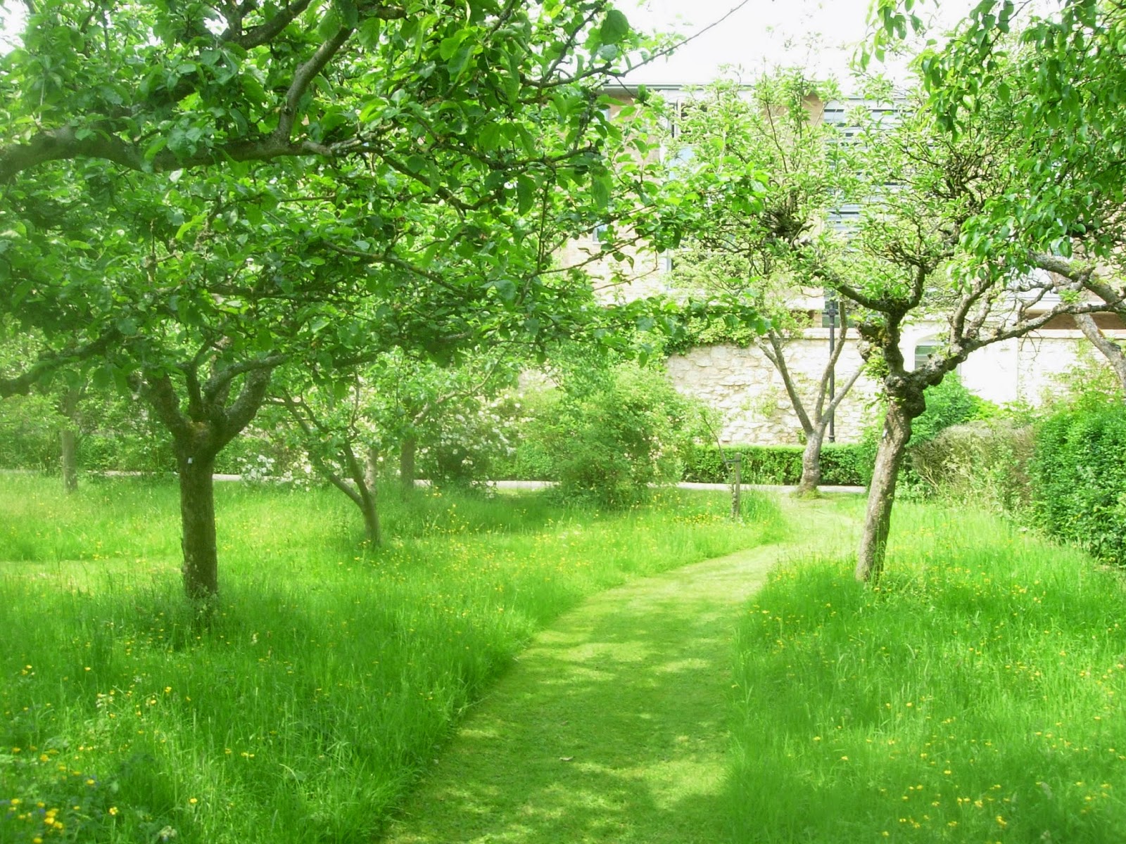
Worcester College incorporates an orchard within its grounds.


Cars are almost entirely banned from the centre of Oxford. This allows streets to be appropriated in the summer for cafes. Park and ride facilities allow motorists to park at the edge of the city and take public transport into the centre.


Bike lanes have been provided throughout the city.


The city’s name refers to its origins as a fording place on a river. The city is sited around the confluence of two rivers, The river Isis  (Thames)  and Cherwell. These, together with the Oxford canal have created ample opportunity to create linear parks.


The Oxford canal on the right with the Isis (Thames) to the left.


The river Cherwell resembles an Indian river in that it seems to have two river beds. Its flood plain creates a linear park in the centre of the city.


Privacy is allowed in the college grounds by the simple device of the railing. This allows views in but prevents straying members of the public wandering in.


An additional   level of privacy is created by the simple device of the wall used to enclose   the famous quadrangles.


Large areas of green land has been preserved quite close to the city centre.  A good example of this would be Christchurch Meadows.


Oxford’s Science Park can be found on the edge of the city. Its presence is signified by a large black building visible from the A4074. Much of its layout follows the familiar pavilions-in-the-park  type theme.  Although such developments have become ubiquitous in Britain in recent decades, the landscape strategy clearly attempts to respond to the specific as opposed to generic qualities of the site. Many of the buildings are orientated towards Littlemore Brook which is provided with a riverside walk.


Most the Science Park’s  streets are  devoid of any pedestrian life.


Extraordinary resources have been lavished in landscaping  car parking spaces.

Although the development has been provided with gymnasium plus café it is doubtful whether this can be really considered to be a mixed-use development.

There has been much discussion over the appropriate form the next wave of British urban development should take. An approach which I think has much potential is that of the retrofit. A business park such as this could be seen as the nucleus of new neighbourhoods as opposed to mono-functional zones. The thinking behind the business park presumably is that the tranquility necessary for work is only possible in buildings separate from city centres, surrounded by countryside. The example of Oxford city centre shows that very private activities such as teaching facilities, libraries and halls of residence can be successfully incorporated into a city centre.

An intellectual like Paul Virilio has often argued that settlement patterns are often determined by transportation patterns. The car-based convenience of the business park can be contrasted with the transport strategy of a historic city such as  Oxford where visitors  usually use park and ride  facilities, leaving their cars on the outskirts of the city to make their journey into the city centre by bus. The challenge to urban designers  is to produce the urban environments of the future where the environment is of such high quality that people will actually be prepared to give up their cars or at least accept a greatly reduced role for them. Perhaps the business people of the future will adopt the practice of Oxford students who often cycle to work.


The expansion of a  city like Oxford might provide an ideal site for growth to solve Britain’s  housing shortage. A site such as Oxford Science park could have  housing developments  built next to them together with some retrofitting of the office buildings into more mixed-use functions.

Another strategic criteria for town expansion is the issue of city size.  The Garden City and  New Town Movements always proposed that cities should only be allowed to reach a certain size and that somewhere between 33,000 to 200,000 was the optimum size for a city. Obviously Oxford would fulfil this criteria. The site is several miles from the city centre, separated by many “green breaks”.

Lancelot  ”Capability”  Brown  acquired his nickname through his habit of telling his clients that their sites had  great “capabilities.” Surely a site like Oxford Science Park has the capability  to provide a starting  point for a mixed-use expansion of Oxford.


( Thanks to Google for aerial view of river Cherwell)

Tuesday, 25 March 2014

Bournville: an example of business-led urban design.


If I keep adding posts dealing with The Garden City Movement I fear  I will start repeating myself at least as far as the writing goes. Nevertheless even a generic form can allow for  fascinating, infinite  variations, providing lessons which are eternally relevant. For this reason I am posting a piece on Bournville, Birmingham’s great example of The Garden City Movement. This can be seen as a photo essay with perhaps similar postings to come.


                                               Typical semi-detached housing


Bournville was created by  George and Richard  Cadbury  who wished to relocate their chocolate factory from a cramped, city centre site to a location more amenable to expansion. They chose a site four miles from the centre of Birmingham well connected by the new railways and canals, close by the Bourn Brook.
The original move took place in 1879. In 1893, 120 acres of land was purchased to create a model village. By 1900, 313 cottages and houses had been built, at which stage ownership passed to the Bournville Village Trust.


                                 Shops with other uses above by the village green


                                                    Bournville Rest House


                                                     Bournville Primary School


                                               Bournville Center for Visual Arts

A factor of urban design which must always be considered in, of course, the economics of a  creation of a  proposal. We live in an age of small government whose most overriding concern often seems to be  shifting financial responsibility away from the public to the private. It is heartening to see a business-led development of such high quality. Businesses should take note that there are a huge number of benefits entailed when a development like this is undertaken. Firstly, naming a town after a company’s product generates a massive amount of favourable publicity for a company. Why, indeed, should the provision of things such as affordable housing and good schools be left to the government? Businesses with access to good financial resources should realise that provision for staff goes way beyond mere wages. Businesses which find it difficult to recruit high-quality staff could look at Bournville and see what is being offered here. I hesitate to use a word as  repellent as “lifestyle” and would rather focus on essential matters such as affordable housing and good schools.


                                                                    Map


                               Cadbury Factory with cricket pitch in the foreground


                                                                 Church


I think it clear that my photos convey what a remarkable achievement Bournville is. It has, as I never tire of saying, the four qualities that really make a neighbourhood; access to public transport, a walkable scale, a mixture of uses and public spaces of real quality.


Friday, 18 November 2011

What would Harold Say?


 Amid the controversy surrounding the National Planning Policy Framework as way of finding our bearings perhaps it would be worth while casting our minds back to the planning policies of previous Conservative governments. As I have already indicated here, I believe that the planning-free-zone of the 1980s often  led to urban design of a very poor quality. Perhaps if we extend the time frame further, as far back as the 1950s, then we can see examples of urban design which seem relevant today. The fact that the Conservatives won an election in  1951 and the subsequent popularity of that Government has often been attributed to  Harold Macmillan’s grasp of this issue. His willingness to campaign on this issue prior to the  election and the success of his tenure as Minister for Housing from 1951 -1954 where he famously met his target of 300,000 new homes a year, surely holds lessons for our current government. The failure of  the current Conservative Party to appreciate this lesson might explain their failure to secure an outright majority at the last election.

 Reviewing planning policies as they currently stand, the approach to planning of the  last 10-15 years i.e. the Blair years were generally determined by John Prescott. John Prescott’s approach to planning and urban design was basically guided by the report “Towards an Urban Renaissance”,  probably the most influential planning document  during this period. “Towards an Urban Renaissance”  was produced by the Urban Task Force chaired by Richard Rogers so it really was his brainchild. Rogers argues for the polycentric city, that a city should not be seen as a single entity but as a series of villages or neighbourhoods.
 
Much of Roger’s argument revolves around density. This is measured by the acronym DPH  (dwellings per hectare.)  Only when this reaches a critical level is it possible to create a catchment area that can justify local services such as a doctor, bus stop, shops, school etc. This is the way in which a series of mixed-use, pedestrian-scaled  neighbourhoods are created. The walkable neighbourhoods thus generated are more sustainable than a neighbourhood which is wholly residential where people have to drive to an out-of-town shopping centre. A walkable neighbourhood also has social benefits were people will meet each other unlike a neighbourhood where the connections are all made with cars.
 
The idea of the neighbourhood is probably the most interesting and valid initial approach to urban design. It needs to be mixed use and walkable scale. One of the reasons that the out-of-town shopping centres  became so popular, an  approach which became widespread in the 1980s , was simply that they had large, horizontal  car parks. However, in architectural and urban design terms the overall quality of these developments was often very poor. Car parks constitute nothing more than an urban wasteland. And one of the overall effects of out-of-town shopping centres was that many town centre shop closed; this led to what planners refer to as the doughnut syndrome – towns with holes at the centre. So a third quality is added to the requirements of a neighbourhood. A good public transport system obviating the need to always travel by car.
 
The idea of the neighbourhood is valid, with it’s 3 qualities, as I have outlined above, and  can be achieved with a majority of the dwellings consisting of houses with gardens. This has been proven to work, for instance, by the British  Garden City Movement. I recently gave an example, namely Hampstead Garden Suburb. This has the  quality of a village with a railway station at the centre.
 
It could be argued that the present Government needs a specifically conservative approach to this, in the sense that it is  something generated by private money rather than public money. To achieve this I would say firstly, that ideally an important step would be getting developers interested in the vitally important principle of mixed –use. Rather than building mono-functional zones such as out-of-town shopping centres and business parks, they should be encouraged to embrace mixed-use, both as buildings and neighbourhoods. This can be profitable as well as attractive. Instead of the approach of the single-story shopping shed surrounded by a car park you can have a multi-story building with shops on the ground floor and flats or offices above. This obviates the need for a enormous car park and if it is integrated into it’s neighbourhood, means that there will be houses with gardens within walking distance. All these activities can feed off each other, generating profits , with beautiful squares and landscaped streets instead of over-scaled vehicle parking.
 
As well as persuading developers of the benefits of mixed-use, we need to rethink attitudes to transport. David Cameron has said that he wants the present government to be the greenest ever. The initiative of the feed-in tariff was a good policy. It means that people can install photo-voltaic panels on their roof and sell the surplus electricity back to grid, meaning that the initial investment can be paid for in a much shorter period of time. However, finding a sustainable approach to transport is going to be much, much more difficult. Although we live in an age of diminishing oil resources, I personally doubt whether the electric car, which some people put their faith in, really is the answer. At present, they take 5 hours to recharge and have a range of 100 miles. I also doubt if the car powered on bio-fuels in the answer since their production depends on turning valuable farming land away from food production. What is necessary is to re-invent the notion of public transport. You may argue that this is socialist, because collective, rather than individual and conservative, but I am not sure I would agree. We already pay for roads collectively through our taxes so perhaps a proportion of this money should be  spent every year on public transport. All the roads we have paid for and built will arguably be empty in a few years time so perhaps we need to start modifying them for new types of transport i.e. trams can be retrofitted to existing road infrastructure. All this can be payed for by tax contributions and private developers through thinks like Section 106 agreements ( unfortunately these will be abolished under the NPPF). It is obviously easier to link up a tram to a constant power source than a car i.e. an overhead cable rather than a battery which goes flat every five  hours. The electricity can come from renewables i.e. solar, wind, ground source heat pump, CHP, biomass even nuclear. This entire approach will entirely change the look and feel of our towns and cities, reducing sprawl (which is often caused by cars) and leading to mixed-use neighbourhoods. This approach need not be excessively dense, as the example of the garden city movement shows.
 
Coming back to Harold Macmillan, we should really reflect on what planning policies he implemented in the 1950s and 1960s. He did  not simply advocate the relaxation of planning in favour of a developer’s free-for-all. The housing targets he set and met  were placed within the context of the planning policies of the day, policies evolved by figures such as Patrick Abercrombie and Frederic Osborne, both of whom were among the most gifted planners this country has ever produced. They were responsible for policies which included the New Towns, Green Belts and inner-city renewal. Looking back on this now, with over 50 years of reflection to draw on, it is clear that not all of these policies were unqualified successes.  Inner-city renewal often took the form of demolishing housing considered unsalvageable because  of sub-standard quality or because of war damage, and replacing it with concrete high-rises. Not all this housing is as bad as is now often supposed. Some of it was actually quite good. The high-rises, from the gleaming white concrete of early modernism to the grey concrete of the Brutalist era, were a mixed blessing, ranging in quality from good to awful. Some have called for them to be demolished and sometimes this approach has been adopted. However, it is noticeable that no one has called for the New Towns to be demolished and examples of this genre, such as  Harlow and Bracknell, are still viewed as attractive places to live. No one as far as I can see, wants to see the Green Belts built on. Hence we can still look back on the Macmillan era as a time when planning was approached responsibly and from which we can still draw relevant lessons today.

A responsible approach to urban design needs to be aware of the two scales at which towns and cities are experienced. I have already discussed the first scale, that of the neighbourhood. The next scale is that of the overall city i.e. a polycentric cluster of neighbourhoods. Urban life can, of course, be exciting, with all the facilities we associate with city life. Its drawback can be that it is actually too stimulating. People feel permanently exhausted, trapped as they are in built-up environment, cut off from nature. This can be mediated by building city neighbourhoods with a high proportion of the dwellings composed of houses with gardens. Another form of mediation is to deliberately limit a city’s size. This can be done by creating satellite towns. This was the idea behind the New Towns of  Macmillan’s time and indeed the Eco Towns policy, proposed in the last days of the Labour Government.

Many have voiced fears of a planning free-for-all and indeed it seems that under the draft National Planning Policy Framework, local authorities who do not have a core strategy in place by April 1st 2012 will be able to exercise no control over development in their area. It often seems that all planning policy in this country is directed by developers, nimbys, the heritage lobby and organisations such as the Campaign to Protect Rural England. All these groups sometimes pursue irreconcilable goals; this state of affairs will only get worse if there is not a proper planning policy to reconcile the wishes of all the various groups. Rarely is there a planning policy aimed at meeting the needs of all the British People. Many fear that the  effect of the NPPF, if it goes through, will produce very poor quality development which will not meet their housing needs or other building needs.

Tuesday, 1 November 2011

The British Garden City Movement: Hampstead Garden Suburb

When trying to describe a specifically British type of urban design, some people fall into the error of recommending the British Garden City Movement justifying their argument on the reason that suburbia, they say,  is basically what British people want. The British Garden City Movement was one of the most remarkable urban design movements this country has ever produced. But it had nothing whatsoever to do with suburbia.

In order to justify that statement, I have chosen to look at an example of the Garden City Movement from 1909, Hampstead Garden Suburb. It is true that the typology of the house with garden is still relevant. However, I would argue that there at least three basic ideas that distinguish a Garden City from conventional suburbia:

Firstly, although both contain houses with gardens, A Garden City will also contain places for work, education, worship, shopping etc. In short, although a Garden City will try to create quieter, residential areas, it will also try to embrace the principle of mixed-use. It is worth remembering that the Garden City movement took place at time before mass-car ownership ( although it did take place during the age of the railways; all of the original garden cities have railway stations at the centre i.e. Letchworth, Welwyn, Hampstead and Bedford Park.) Modern development which includes out-of-town shopping centres plus suburbia cannot be considered an equivalent because a genuine garden city would contain shops within walking distances of residential buildings.

Secondly, in order to maintain a balance between built-up space and green space, a balance vital for health  and happiness,  a Garden City can only be allowed to reach a certain size, at which point a new Garden City must be started elsewhere. The ideal size  is based on a module of a neighbourhood or pedestrian-shed. One such module is a village really; how many such modules can be allowed to accumulate before a new city must be founded? Ebenezaar Howard  considered that the population of a garden city should be 32,000. According to the Rogers-led Urban Task Force the number of people necessary to support a hub of local services is 7500. So according to Ebenezar Howard’s approach, a garden city will contain about 4 neighbourhoods or pedestrian sheds. The illustrations to “Garden Cities of tomorrow”  don’t seem to bear this out but these  were only meant to be diagramatic.

The third principle is green belts, which define the edge of the city, maintaining a proper relationship between town and country. Strong planning controls would be necessary to prevent people building on them. Ebenezer Howard’s original proposals  allowed various activities on the green belt such as convalescent homes and agriculture; he envisaged them as growing their own food. A public transport infrastructure was provided though these were the days before mass car ownership and its attendant congestion had become a real problem.


This vision was realised at Hampstead Garden Suburb and indeed a host of other lessons can be drawn from this example as well. If one was going to learn lessons from this, one might as well be honest and admit that the some of the original principals have  been eradicated. Features such as a green belt and finite size were part of the original design but  are no longer there. The relentless growth of London meant this satellite was absorbed into Greater London.

One key  quality has been conspicuously retained, that of a mixed-use neighbourhood. Within a walkable-scaled area you will find housing, shopping, education and places of worship. What other qualities have been achieved? As a way of answering that question, perhaps the best method would be to walk the reader through a sequence of spaces, starting with what was conceived as the gateway to the entire project, the following buildings at the North of the site, at the junction of Finchley Road and Bridge Lane/ Temple Fortune Lane.


One of the eternal rules of good urban design seems to be that density can be increased where there is access to good public transport. Strangely, this rule is broken here. The high density part of the development is placed at the opposite end to that where the tube station is, Golders Green tube station.  These buildings are consciously modelled on medieval examples but can be seen as exemplars of what is now taken as a commonplace of good urban design; mixed-use. These buildings contain shops at ground floor and flats above. One might contrast this with single storey shopping buildings, without a different use above, which might be taken as a leitmotiv of bad urban design. As well as a failure to adopt the mixed-use approach, another fault of this type of building is the lack of height and hence a failure to create a sense of enclosure in the external spaces.

Several types of external space have been created. The first might be taken as a busy road with activities for pedestrians at the bases of the buildings.


Quieter residential streets have been created.

One of the great types of space created in this example of the Garden City Movement, and indeed in most of them is the green set in the close. Here they vary:


From closes surrounded by large detached houses.


To those enclosed by smaller, it would seem terraced houses.

This type of housing is also found at the Central Square which forms the centre of the whole community. 


The main public  buildings here  are by Lutyens. Whilst many agree that neighbourhoods need a centre, opinions differ as to what this should consist of. Whilst some would like to see all types of communal buildings at the neighbourhood centre, others take a  different view. Some take the view that whilst communal buildings such as schools should be placed at the centre, shops should be placed on  arterial road on the neighbourhood periphery, where they can attract passing traffic. This does seem to be the approach taken at Hampstead where Henrietta Barnet, the client for the whole project,  took many of the strategic decisions. With true Victorian zeal, believed that alcoholic drinks were a form of wickedness. She would not allow pubs or even shops around the main town square. The result is  a square occupied by two churches and the Henrietta Barnett School for Girls.


This has recently been subject to an interesting extension by  Hopkins Architects.


Streets are aligned to frame the views of the main public buildings


Hampstead garden Suburb has lost its character as a village separate from London though part of its green belt was preserved as an extension to Hampstead Heath. It remains as  a good example of a neighbourhood. I would argue the generic neighbourhood has four qualities: mixed-use, pedestrian scale, access to public transport and public spaces of real quality. Hampstead Garden Suburb has these in spades.

( Thanks to HGS Trust for the map of Hampstead Garden Suburb and Simon Kennedy, architecturalphotographer, for the photo of the extension to Henrietta Barnett School © Simon Kennedy 2011).